Have you ever wondered how your phone knows exactly where you are when you open Google Maps or another navigation app? Your smartphone can determine your location using a combination of GPS satellites, mobile networks, Wi-Fi networks, Bluetooth signals, and sensors.
GPS, or Global Positioning System, is one of the most important technologies behind modern navigation. It allows compatible devices to estimate their position on Earth by receiving signals from satellites orbiting the planet.
What Is GPS?
GPS stands for Global Positioning System. It is a satellite-based positioning system originally developed by the United States. The system consists of satellites that continuously transmit signals containing precise timing and orbital information.
A GPS receiver, such as the one inside your smartphone, receives these signals and uses them to calculate an estimated position on Earth.
Although people commonly use the word GPS for phone location, modern smartphones can use several global navigation satellite systems, including GPS, Galileo, GLONASS, and BeiDou. Using multiple satellite systems can improve the availability and accuracy of positioning.
How Does GPS Work on Your Phone?
The basic principle behind GPS is surprisingly simple: your phone measures the travel time of signals received from satellites and uses those measurements to estimate its distance from each satellite.
Because radio signals travel at approximately the speed of light, even a very small timing error can produce a significant distance error. GPS receivers therefore use highly accurate timing information and signals from multiple satellites to calculate a reliable position.
Step 1: Satellites Broadcast Signals
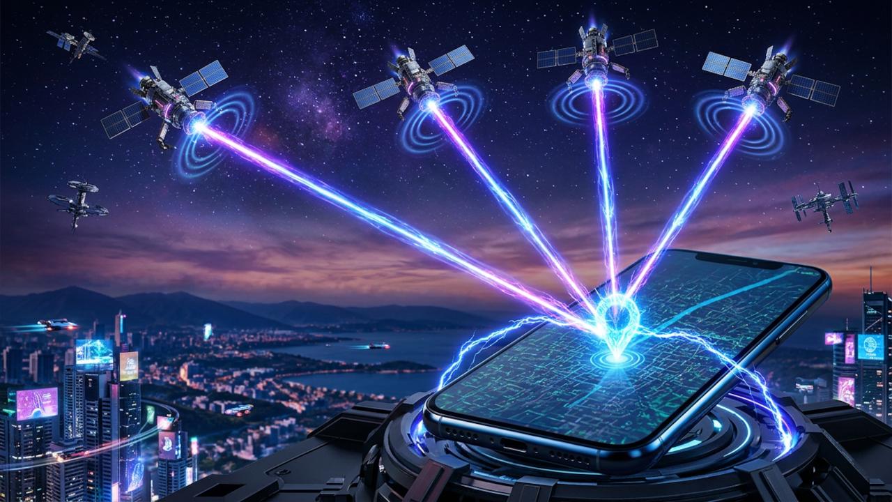
Navigation satellites continuously broadcast radio signals toward Earth. These signals contain information that helps a receiver determine where the satellite was and when the signal was transmitted.
Your phone does not normally send a GPS request to the satellite. Instead, the phone listens for signals transmitted by the satellites and processes them locally.
Step 2: Your Phone Receives the Signals
The GPS receiver inside your smartphone searches for signals from visible satellites. The phone's antenna receives these very weak signals and the positioning hardware processes them.
The receiver identifies satellites and compares the timing information in their signals with its own clock. This allows it to estimate how long each signal took to travel from the satellite to the phone.
Step 3: Your Phone Calculates Distance
Once the phone estimates the signal travel time, it can calculate an approximate distance from each satellite.
The basic idea can be represented as:
Distance = Signal Travel Time × Speed of LightStep 4: Your Phone Uses Multiple Satellites
One satellite is not enough to determine your exact position. Your phone needs measurements from multiple satellites to calculate where the distance estimates intersect.
This process is commonly described as trilateration. It is important to distinguish trilateration from triangulation: GPS primarily uses measured distances rather than angles to determine position.
Why Does GPS Usually Need at Least Four Satellites?
A smartphone needs to estimate several unknown values, including its position and the difference between the receiver's clock and the highly accurate clocks used by navigation satellites.
Signals from at least four satellites can provide enough independent measurements for a typical three-dimensional position solution while also helping correct the receiver's clock error.
| Satellite signals | What they help determine |
|---|---|
| 1 satellite | Provides a distance measurement, but not a unique position |
| 2 satellites | Narrows down the possible position |
| 3 satellites | Can provide a two-dimensional position under suitable assumptions |
| 4 or more satellites | Allows a typical three-dimensional position solution and receiver clock correction |
What Is Trilateration?
Trilateration is a method of determining a position using distances from known reference points. In GPS, the satellites act as those reference points.
Imagine that your phone knows it is approximately 20,000 kilometers from one satellite. That information places the phone somewhere on an enormous sphere around that satellite. A second satellite provides another sphere, narrowing the possibilities. Additional satellite measurements narrow the location further until the receiver can calculate a position.
Does GPS Need the Internet?
No. GPS positioning itself does not require an internet connection. A phone with a working satellite receiver can calculate its position from satellite signals even when mobile data and Wi-Fi are unavailable.
However, many location-based apps use the internet for other purposes. A navigation app may need an internet connection to download map data, traffic information, business information, or other online services.
GPS vs Mobile Network vs Wi-Fi Location
Your phone's location system is not limited to GPS. Modern smartphones can combine several sources of information to estimate your location more quickly and accurately.
| Technology | How it determines location | Typical characteristics |
|---|---|---|
| GPS / GNSS | Satellite signals | Can provide accurate outdoor positioning |
| Mobile network | Nearby cellular towers | Useful when satellite signals are weak |
| Wi-Fi | Known nearby Wi-Fi networks | Can work well indoors and in cities |
| Bluetooth | Nearby Bluetooth beacons or devices | Useful for short-range positioning |
What Is Assisted GPS or A-GPS?
Assisted GPS, commonly called A-GPS, uses assistance data obtained through a network connection to help the phone determine its position more quickly.
Instead of starting with little information and searching for everything from scratch, the phone can obtain information such as approximate satellite data or time information from network services. This can reduce the time required to obtain an initial position.
Why Is My GPS Sometimes Inaccurate?
GPS accuracy can change depending on your surroundings and the quality of the signals received by your phone.
- Buildings can block or reflect satellite signals.
- Dense urban areas can create signal reflections between buildings.
- Being indoors can significantly reduce access to satellite signals.
- Trees, mountains, and other obstacles can reduce the number of useful satellite signals.
- Poor satellite geometry can make the position calculation less precise.
- Atmospheric conditions can introduce small signal delays.
- The phone's hardware and antenna design can affect positioning performance.
Why Does GPS Work Better Outside?
Navigation satellites are above the Earth, so a clear view of the sky generally gives a phone access to more useful satellite signals.
Inside buildings, signals may be weakened or blocked by walls, roofs, metal structures, and other materials. The phone may then rely more heavily on Wi-Fi, cellular networks, sensors, or other positioning techniques.
Why Does Your Location Sometimes Jump Around?
You may occasionally see your location marker move slightly even when you are standing still. This happens because the phone is estimating your position from measurements that contain small errors.
Signal reflections, atmospheric effects, satellite geometry, sensor information, and changes in the available signals can all cause the estimated position to move. Location software can combine multiple measurements and sensor data to smooth these changes.
How Does Google Maps Know Which Road You Are On?
A navigation app can use your estimated location together with map data, movement information, road networks, and other available signals to determine which road you are likely traveling on.
For example, if your location estimate is close to a road, the application can compare your movement with the available road network. This can make the displayed position appear more stable than a raw satellite position alone.
Does GPS Track You All the Time?
The GPS receiver does not automatically mean that your location is being uploaded to a remote server. Satellite signals are broadcast toward Earth, and the receiver in your phone can process them to estimate its position.
However, apps can request location access and may use network services to transmit or process location information depending on their design and permissions. Your phone's operating system controls which apps can access location and what permissions they have.
Can GPS Work Without a SIM Card?
Satellite positioning can work without a SIM card because the phone's GNSS receiver receives signals directly from satellites. A SIM card is primarily associated with cellular network services, not the basic satellite positioning calculation.
However, features that depend on cellular data, such as downloading online maps or obtaining network assistance, may not work normally without a suitable network connection.
Can GPS Work Without Mobile Data?
Yes. GPS positioning can work without mobile data. The main limitation is that applications may not have access to online map tiles, traffic information, search results, or other internet-based services.
This is why offline maps can be useful when traveling through areas with poor or no cellular coverage.
How Accurate Is Phone GPS?
The accuracy of smartphone location varies considerably. Under good outdoor conditions, a modern smartphone can often determine its position within several meters, but the actual result depends on the device, environment, satellite visibility, and positioning techniques being used.
Accuracy can become much worse indoors, near tall buildings, or in areas where satellite signals are obstructed or reflected.
GPS, GNSS, and Location Services: What's the Difference?
| Term | Meaning |
|---|---|
| GPS | The satellite navigation system operated by the United States |
| GNSS | General term for satellite navigation systems such as GPS, Galileo, GLONASS, and BeiDou |
| Location Services | The broader system on a smartphone that can combine satellite, cellular, Wi-Fi, Bluetooth, and sensor information |
What Happens When You Open a Navigation App?
When you open a navigation application and request your current location, the phone's location system can gather information from available positioning sources. The GNSS receiver may search for satellite signals while the device can also use nearby networks and sensors.
- The application requests your location.
- The operating system checks the available location sources and permissions.
- The phone receives satellite signals if they are available.
- The phone may use Wi-Fi and cellular information to assist positioning.
- Sensors such as the accelerometer and gyroscope can provide movement information.
- The location system combines available measurements to estimate your position.
- The navigation application displays your position on its map.
Why Does GPS Take Time to Find Your Location?
When a receiver has little recent positioning information, it may need to search for satellite signals and determine which satellites are available. This can take longer than when the device already has useful assistance information.
Network assistance, previously stored satellite information, a clear view of the sky, and modern multi-constellation receivers can all help reduce the time required to obtain a position.
Does GPS Use a Lot of Battery?
Using location services can consume additional battery power, but the amount varies significantly depending on the device and application. A navigation app that continuously tracks movement, keeps the screen active, uses mobile data, and performs frequent location updates can consume considerably more battery than an occasional location request.
Modern smartphones use power-management techniques to balance location accuracy, update frequency, and battery consumption.
GPS vs Google Maps
GPS and Google Maps are not the same thing. GPS is a satellite positioning technology, while Google Maps is a mapping and navigation application.
A navigation application can use GPS or other GNSS signals to determine your position, then combine that information with digital maps, roads, places, routing data, traffic information, and other services.
Frequently Asked Questions
Does GPS work without internet?
Yes. GPS positioning itself does not require an internet connection. However, applications may need internet access for online maps, traffic information, searches, and other services.
Does GPS work without a SIM card?
Yes. A phone's satellite receiver can calculate its position without a SIM card. Cellular services and internet-dependent features may not be available.
How does a phone find your location?
A smartphone can combine GNSS satellite signals with information from Wi-Fi networks, cellular networks, Bluetooth, and device sensors to estimate its location.
How many satellites does GPS need?
A typical three-dimensional position solution requires measurements from at least four satellites because the receiver must determine its position while also accounting for its clock error. More visible satellites can provide additional measurements and improve robustness.
Can GPS work indoors?
GPS signals can be significantly weakened indoors. Phones may therefore use Wi-Fi, cellular networks, Bluetooth, sensors, or other positioning methods to estimate location.
Why is my phone GPS inaccurate?
Common causes include blocked satellite signals, buildings, signal reflections, poor satellite geometry, atmospheric effects, and limitations of the phone's hardware or surrounding environment.
Is GPS the same as location services?
No. GPS is one satellite positioning system. Smartphone location services can combine GPS and other GNSS systems with Wi-Fi, cellular networks, Bluetooth, and sensors.
Conclusion
Your phone's ability to determine its location is the result of several technologies working together. Satellite navigation systems provide the fundamental positioning measurements, while Wi-Fi, cellular networks, Bluetooth, and sensors can help improve speed, availability, and accuracy.
The key idea behind GPS is measuring the travel time of signals from multiple satellites and using those measurements to calculate the receiver's position. That simple principle powers navigation, ride-sharing, delivery tracking, fitness applications, emergency services, and many other smartphone features.